
MacFarlane sites survey
Survey of archaeological sites in Arrochar Parish
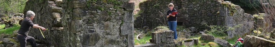
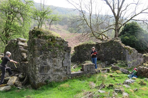
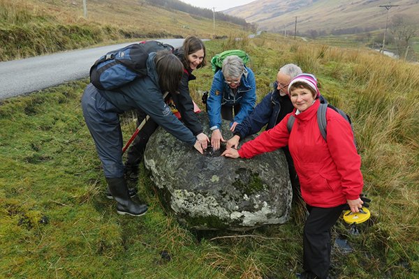
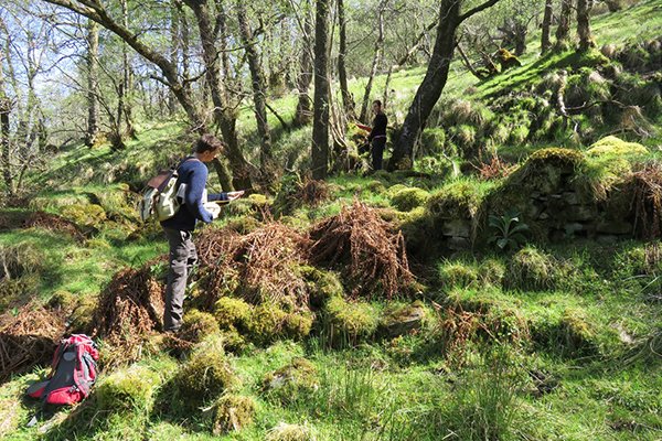
We’re delighted to report that Clan Macfarlane Worldwide recently generously funded Heather James (Northlight Heritage and Calluna Archaeology) to carry out some survey work of known and possible archaeological sites in Arrochar Parish. This survey, coordinated by Heather and implemented with the help of local volunteers, Glasgow University students, and members of ACFA (the Association of Certificated Field Archaeologists) aimed to build up a fuller picture of how and where people lived in the area, particularly during the time when the lands around Arrochar were the territory of the MacFarlane Clan (1225-1785).
Given the potentially huge area, much of it made up of mountainous terrain, it was decided to focus on trying to identify any physical remains of sites mentioned in old documents and/or on old maps. This was complicated by the different names/spellings given to the same sites over time, the potential for sites with the same name to move location, and the understandably sketchy nature of early maps….. These targeted sites, together with any other sites discovered incidentally, were recorded and photographed.
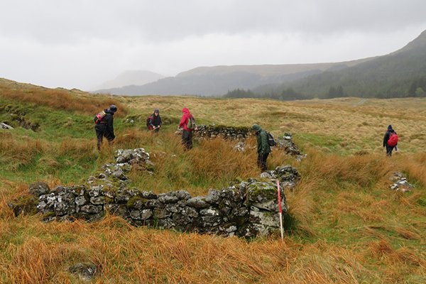
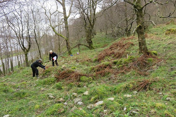
Surveying was carried out over 15 days, spread from March through to May, encompassing days with torrential rain and scorching (by Arrochar standards…) heat. Huge thanks to the dedicated volunteers for persevering! Significant progress was made in discovering new sites, as well as rediscovering previously known sites that had since been lost, though many more remain to be investigated.
Clan Macfarlane Worldwide have kindly agreed to let us pass on the results of the survey here, presented as summarized daily reports written by Heather. I have omitted the daily references to cups of tea, though their importance in maintaining morale should not be underestimated! Please click here for the full report.
Day 1 March 24th
A very successful day, despite the rather damp weather. Seven of us walked to Stuck na Cloich (also known as ‘the Black Village’. There is a good existing plan of this settlement, but we added some further information on the slope of the site and how some walls abut others, suggesting phasing of the settlement. We also thought that the large structure in the east may have additional entrances and could have been a two-roomed structure. Worth a revisit later on.
We also found a two-roomed building further south that I had spotted on an aerial photograph. This building was previously unrecorded.
We then walked further south looking for Upper Stuckintibert, as shown on Roy’s map. We found some enclosures and rig and furrow, but no structures.
Day 2 March 25th
The team walked up Glen Douglas in much better weather and recorded several structures and earth banks.
One particularly large structure (Site 11) measured 15.5m × 5.2m and was near to a large kiln-barn. Currently not sure of the name of this farmstead, but will check all the old maps to see if there is a clue.
This south-facing slope would have been good for settlement, but being on the boundary with the lands of the Colquhouns, it was perhaps seen as less secure.
We also visited the possible motte at Inverbeg.
Day 3 April 3rd
Another successful day in Glen Douglas. We found a deserted settlement described in the records as three unroofed structures, but it is in fact four unroofed structures and two enclosures. It is within the forestry, but they have left the settlement unplanted which is good, though there is a little natural regeneration. This may be the unnamed settlement shown on Ross's map of 1777 between Inveruglas and Gartanfarn. It is probably 17th/18th century at the latest and might even have earlier origins. Well worth a proper survey later on I think.
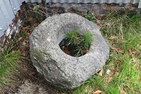
Also found a knocking stone (also known about but no photograph on the records and we have given it a better grid reference).
Also discovered several other previously unknown shielings and rectangular structures - once you get you eye in they start popping up all over the place! Using the aerial photographs to guide us to likely spots is also proving successful.
Day4 April 4th
Monday was a quieter day with only two brave volunteers facing the wet weather. The others did have good excuses, honest. Ian and Katherine are both hardy and experienced so kept cheerful all day, despite the downpour.
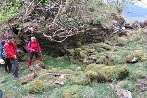
With a small team I thought we should have a look at Creag a'Phuirt opposite Ellan Vhow on Loch Lomond (reportedly the site of a 17th century almshouse). We started in the south where there is a lay by where we could get off the busy road. LLTNP has been doing some tree felling and left the brash lying around, so that together with the general low vegetation, made it difficult to see what the ground was like. There was also a lot of rubbish lying around, which is quite unpleasant.
However, we were excited to find the low remains of a small stone building about 5m × 3.5m. This seems quite small for an almshouse and may have been a fisherman's bothy. Someone had had a bonfire in the middle of it…... There was also some walling nearby enclosing a small inlet in the rocks where small boats could potentially have been brought up against the shore. This area seemed the most likely spot for a building as the shore became steep further north. I have asked a medieval expert for advice on how big an almshouse might be.
We also found a stretch of the old military road surviving just east of the new road to the north of the bothy. This survived as a narrow terrace about 3m below the modern road, which we could trace for about 50m. (Ian later pointed out that the old military road up Loch Lomond was higher up the hill at Creag a Phuirt than the modern road (see the 1st edition OS) so the terrace was perhaps the old drove road.)
While we were at the north end of the loch, I thought we should scout out the West Highland Way and see how long it might take to get to the settlements on the east side of the loch. We reached Blairstainge in about 45 mins from Inverarnan. There are several structures here and a large kiln. We will check how much has already been recorded and return later.
Day 5 April 7th
Today we enjoyed the best weather so far. We returned to Glen Douglas and continued where we left off, east of Invergroin.
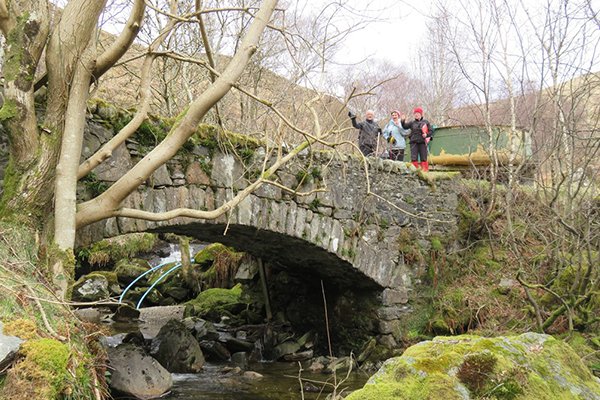
We continued to find small structures and areas of cultivation along Glen Douglas, indicating how populated the glen used to be. We met up with Peter Robertson and his wife who currently live at Invergroin who had pictures of the old school at Tullich. He also pointed out the old bridge near his house where the old road used to go until about the 1950s.
There are also settlements on the south side of the river, but that was in Luss parish (Colquhoun land), so we remained north of the river. Roy's Military map of around 1750 and Charles Ross's map of 1777 depict several settlements along the glen. Some of these relate to the current farms, such as Inveruglas and Invergroin, but others have moved (such as Tullich). We think we have found Gartanfarn (shown on Ross) and also the unamed settlement between Inveruglas and Gartanfarn.
Tullich Hill was not part of Arrochar parish, probably because it was part of Tullich farm (originally located to the south west of the hill), which must have belonged to the Colquhouns. (see document sent by Rhona Macfarlane).
Day 6 April 8th
Today we carried on up Glen Douglas after getting in touch with the Ministry of Defence, who have a depot at the far west end of the glen.
We started at the west end and worked our way back to Invergroin. There were some earth and stone banks, but we only found two small clearance cairns and a feature which could possibly be a circular structure, but could also be natural.
We then visited the site of Camus nan Clais, which is depicted on the 1st edition OS map on the west shore of Loch Lomond and is referred to in documents as a mill, being fed from the Fairy Loch. We managed to trace one of the rectangular structures, but it looks as if the rest have been deliberately demolished and the stones scattered, perhaps when the road was changed into three lanes.
Day 7 April 14th
We started planning one of the old settlements (Site 18) in Glen Douglas that I think might be 18th century at least, if not older. It is not shown on the maps and so we don't know its name; however, by comparing the 1784 rentals and the 1777 Charles Ross map, I think I can make a case for it being the site of 'Greitnein,' which is probably a phonetic spelling of something in Gaelic. We did not quite finish planning the site yesterday because it was quite a challenge, being on a steep slope and using only tapes (taped-offset method).
Day 8 April 15th
Today we finished the survey of ?Greitnein and started to plan another site in the glen, which I think was called Gartanfaired/Gartanfarn (Site 33), again based on the 1784 rentals and the 1777 map. This site is opposite Down/Duin and is shown but unnamed on Roy's map as a cluster of houses (dated about 1750).
More historical research is needed on these two sites so that we can be more certain that we have identified them OK.
Day 9 April 16th
On Saturday we decided to explore the area to the west of Ardvorlich on Loch Lomondside. I was aware that the Starbuck survey had found structures in the hills to the south-west of Ardvorlich, so I wanted to look to the north-west and west.
We parked in a lay by and walked through the woods to a place where we could cross the railway safely - by an old footbridge which was marked on the map. This took us up into the hills to the NW of Ardvorlich where we found an ideal spot for settlement in a valley above the loch side. We recorded two small structures and enclosures here. Coming further south the hill was very steep, boggy and difficult to make our way through because of the brambles.
We headed south towards a 'sheep creep' below the railway, which was actually big enough to walk through and then headed round the hill to avoid cows with their new calves.
We looked at the rectangular features that Preston had spotted on the aerial photographs to the south-west of Ardvorlich and confirmed that these were large concrete bases, brick walls and steps which probably relate to some 2nd WW structures. I am sure some locals will know what they were, but unfortunately we saw no one all day.
We knocked on the door of the cottage at Ardvorlich, but as no-one was in we explored the land behind the cottage where the line of the old military road was still visible. The old bridge across the Allt Ardvorlich has collapsed - possibly quite recently. There were also drystone ruins of older houses at Ardvorlich, some of which were probably depicted by Roy on his map.
That was the last trip till after our visit to Tiree next week. We will start again on Sunday May 8th.
Day 10 May 8th
On Sunday we parked the car at the Beinglas campsite on the east side of Glen Falloch and started walking south along the West Highland Way again. We stopped at the ruins of Stuckam(?a) which is depicted on Roy’s military map over a stream opposite 'Benglash' . There was a substantial building probably dating to the late 19th century, which was surrounded by lots of humps and bumps that were probably the remains of earlier buildings, though few could be identified clearly.
We then walked along the edge of the river, following the route of the old track depicted by Roy, which met the river at a ford, clearly indicated by stones in the river.
We were bemused for a while by something swimming in the river, but my camera's zoom lens allowed us to identify a particularly large frog escaping from our chatter J
I was keen to get to Ardleish further south. There are substantial stone buildings here, also of 19th century date (including a large barn with slit windows) and a 20th century corrugated iron dwelling. There was a 'knocking stone' beside this dwelling.
In the field slightly north of Ardleish were the low stone foundations of a structure, but curiously this did not match the alignment shown in the 1st edition OS map, so perhaps there was some other temporary structure here.
Best of all were the remains of what I suggest may be 'Tighfurt' on Ross’ map of 1777, shown near the island Ellan henrig at the top of the loch (but not depicted on Roy’s earlier map). This site was visible in aerial photographs, and consisted of the low stone remains of two buildings and an enclosure.
Day 11 May 9th
Today was hot again and we headed back to Glen Falloch to check out other structures on the Ist edition OS map.
The first was a single structure shown on the 1st edition OS map as being beside a track. We searched for this using the grid reference and our hand-held GPS. The West Highland Way clearly does not follow the same route as the track shown on the 1st edition map, so we trecked downhill through deciduous woodland. Margaret was the most persistent and climbed a deer fence to see if she could find the structure, which she did. I nick-named this the' Blaeberry House’ because they were growing all over it (as were as a couple of very mature oak trees). Blaeberries sadly not ripe enough to east yet.
This is probably my favourite structure so far, something to do with it overlooking the river, on a knoll and surrounded by woodland. The old track was pretty indistinguishable.
We then headed straight up hill over another deer fence to where a large enclosure and structures are also depicted on the first edition OS map. This enclosure overlooks Blarstainge and must have been an old shieling ground. We found another couple of structure which were not shown on the map, which goes to show that checking out these site is worthwhile.
Very hot work today, but we really don't like to complain as it probably won’t last long.
Day 12 May 13
Today we headed down the east side of Loch Long. We started the walk in Arrochar on a made track which is part of the Three Lochs Way. We went under the railway and headed up the hill where there were great views of Loch Lomond.
The mini-heat wave has finished as it is back to normal cool windy weather. We spread out across the hillside so that we could cover as much ground as possible. Margaret headed up the hill and phoned to say that she had found a structure beneath the bluff. This had not been recorded before. Fiona then found the remains of a small rough shelter in a hidden cleft in the rock, which we speculated would have been a great spot for a whisky still, though there was no water running beside it today (it has not rained for over a week).
We then came down to record the sheepfold at Tigh na Laraich, which is shown on the 1st edition OS map. Although this was latterly designed for the management of sheep, there was evidence for an earlier roofed structure with blocked cruck slots. (A cruck slot is where the roof timbers would have been supported within the stone walls). There were also several blocked entrances showing that there had been more than one phase of use.
Nearby was another structure, which was probably the shepherds house.
We then walked further west looking for a possible feature detected in an aerial photograph, but this just turned out to be where a couple of streams had created a natural, rough rectangular shape.
We then returned to the cars and headed further south looking for the best approach to Craggan Sithe, which was marked as a couple of roofed structures and an enclosure on the 1st edition OS map. This lies on the southern boundary of the parish at the west end of Glen Douglas. We parked at the top of the hill and headed down following an old drystone dyke beside a stream. Sure enough, we found the remains of at least one of the buildings we were looking for. As it was late in the day, we decided to come back tomorrow to record it properly and look for the other structures.
Day 13 May 14
Before heading back to Creagan Sithe, I had a look at the 1st edition map of the site and compared it with the aerial photographs of the area. I got quite excited when I saw what looked like a cairn of stones on the photograph in the vicinity of a rectangular enclosure with a feature marked with four hachures on the map. We searched for the 'cairn' using the GPS, but Ollie found a circular area of long tufted grass at the spot, which I am certain is what I had thought was a cairn on the aerial photograph. This shows how important it is to 'ground truth' features seen on aerial photographs! There was a large natural boulder in the middle of this area which was probably what was being depicted on the map.
We recorded the two structures we saw at Craggan Sithe within the woodland. It is possible that one of the structures we saw was built over a larger unroofed enclosure, as shown on the 1st edition map, which would make it late 19th century in date. It is amazing how ruinous these buildings become once they go out of use. As this site is quite hidden and on a difficult steep slope, the stone walls had collapsed and had not been robbed.
Further down the slope we searched within the dense woodland and brambles for the other structure shown on the map, but could only find a couple of roughly rectangular platforms with no discernible stone foundations. The road was very close by, and we thought that any stone had probably been removed for use elsewhere when the site was abandoned. When that would have been might be revealed by some examination of the Census returns or rentals.
We had some time left so we drove back along Glen Douglas and I showed the team the two sites we had surveyed at Greitnein and Gartanfaired, and they were appropriately impressed J
Day 14 May 19
Thursday was wet again (really wet). Despite that, we headed up Strath Dubh-Uisge to see if we could find some sites, given that Canmore (the national database) included nothing up this glen. I had looked at the aerial photographs of the area and had identified five possible sites and recorded their grid references.
We parked in a layby for the new power station, but as the gate was locked we could not drive further up the new track. Ollie’s navigation skills found us a bridge over the railway, followed by a steep climb up to the waterfalls.
The first two possible 'sites' turned out to be justy streams and geology, but the third was a drystone enclosure, probably a sheep fank. The rain was relentless.
We skipped the fourth site as it was higher up the valley side, and headed for the last one, which was well worth the extra walk. The first edition OS map showed a single unroofed structure, which we discovered just north of the dams. We also found three other small rectilinear structures, possibly shielings. Beyond this, the valley joins with Loch Sloy, but we did not have the time or the puff to venture further.
Day 15 May 20
After the strenuous day we had yesterday, we decided to look more closely at some sites nearer Loch Lomond today.
We started at the Weavers Cottage, Inverhoulin, currently the cafe 'Home on the Loch' . The building on the right is shown on the 1st edition OS map as a roofed structure, and it is still there.
Almost directly south of the cottage were the ruins of a rectangular structure (Site 77) very near a small oval shaped enclosure shown on the 1st edition OS map. Nearer the car park we found the extremely ephemeral remains of a structure (Site 78) shown as roofed, to the south of the cottage. We probably would not have noticed this within the woodland had the map not made us look there.
We then headed up the hill to the route of the old military road, which can just be seen as a level terrace behind the modern house of Blairannaich. The old bridge had been demolished, but the foundations on each side are still there, just discernible beneath the dense vegetation.
We visited the old mill at Portchaible (Starbuck 2011, 71-9) as Sue and Fiona wanted show us the lade and remains of the buildings. We also saw the remains of a structure near the holiday park, which is shown as unroofed on the 1st edition OS (Site 82). This was apparently a 'toll keepers house' and has already been surveyed and partly excavated, producing only 20th century material (Starbuck 2011, 80-82). We also noted a knocking stone at Portchaible, beside the entrance path.
Travelling north we inspected the sheepfold and ford at the mouth of Strath Dubh-Uisge. These have been reported on Canmore, so we only photographed them.
Finally we visited the old site of Garabal, which is beside the A82, just south of Inverarnan. The older site is to the east of the road and the more modern farm is to the west and slightly further north. Unusually, old Garabal had a carved sandstone fireplace, which would suggest that this was not an ordinary crofters cottage, but was perhaps a tacksman's house. 'Garaboile' is mentioned in the 1708 rental (Hill collection), Garba[r]l is shown on Roy's military map, and Garbal on Ross's 1777 map. More research is definitely needed here.
The newer site was apparently roofed within the past 20 years or so (according to Sue Furness), but is now abandoned. Although clearly a house of some substance, the fireplaces were not as ornate as the one at old Garabal.
Blog
Click on the link here to check out our Facebook page.
Events
Click here to find out about forthcoming events and how to get involved.
Timeline
Click here to see our timeline of events.
Location
Click here to find out where the Hidden Heritage Project is taking place.
Contact Us
Click here for our contact details.