
What's New?
Check out our Facebook page for the latest news and blog...
The Dewar Manuscripts comprise a collection of stories gathered by John Dewar between 1863 and 1871. Dewar traveled the Highlands listening to stories and folk tales, and writing them down in Gaelic. The resulting manuscripts, housed at Inverary Castle, provide a wealth of information on the people, places and way of life in the Highlands in the mid-19th century and earlier. Notably, in relation to the Hidden Heritage Project, the decision to excavate near The Manse in Tarbet was partly driven by one of Dewar's collected stories, which suggested that the main house of the MacFarlanes in the 17th century was located at 'Cladach Mor', and was a modest, single-storey thatched house, measuring '34 feet long and 13 broad'. Although we didn't manage to find the house, the story - "MacFarlane of Arrochar and the Laird of Luss" - is an excellent read! What's more, John Dewar was born near Arrochar, at 'Craganbreck' in Glen Callanach, though the exact location of the house remains a mystery. In that light, we're hugely indebted to Alistair McIntyre for allowing us to share the results of his research into the Oswalds, who owned that area at the time, and into the possible location of John Dewar's childhood home. Click here to download Alistair's essay. Volume 1 of the English translation of Dewar's tales is available at Helensburgh and Dumbarton Libraries.
We are also hugely grateful to Clan MacFarlane Worldwide for continuing to fund archaeological research in the area, and for allowing us to share their results below:
Excavation at Ardleish, Loch Lomond. Thanks yet again to Clan Macfarlane Worldwide (CMW) for allowing us to share the results of their latest collaboration with archaeologist Heather James (Calluna Archaeology). An investigation of the deserted settlement of Ardleish, on the NE shore of Loch Lomond, was carried out on behalf of Clan MacFarlane Worldwide over 7 days in 2019 and 2021, to determine if this site might have succeeded the medieval site of Ylen Eunlich, which is thought to have been abandoned in the 16th century. Download the excavation report here.
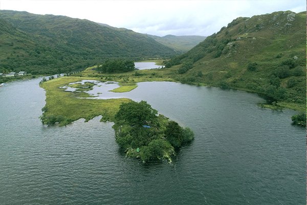
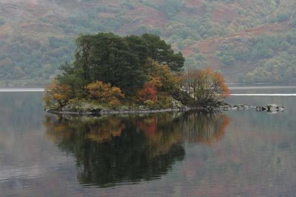
Excavation at the head of Loch Lomond. At the very northern end of Loch Lomond is a promontory of land, which effectively becomes an island after prolonged or heavy rain. The 1st ed. OS map shows the obvious remains of 2 buildings, but Pont's map (around 1596) marks 'Ylen Eunlich', and the accompanying notes say "...hard upon the head of the Loch is Ylen Eaunlich of a flight shot long, with a dwelling upon it, ...". This suggests that the current remains might date to at least the 16th century, or might overlie older remains from that period. We're delighted that CMW funded an investigation of the site in September 2018. Read the results so far here.
Excavation of a possible almshouse at the north end of Loch Lomond. John Macfarlane is said to have built an almshouse at Creag a'Phuirt opposite his house on Island I Vow in the early 17th century. Although the Ordnance Survey found no remains of such a building in 1956, the walkover survey carried out in 2016 (see below) found signs of foundations, and Clan Macfarlane Worldwide funded an excavation in 2017. Find out more here (and see a video here).
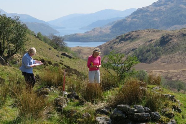
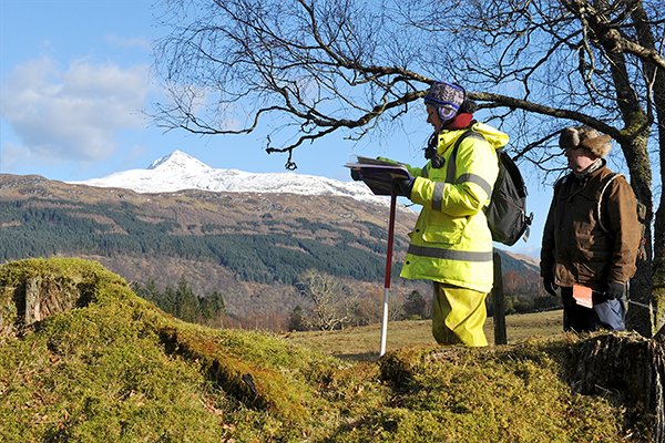
Survey of archaeological sites in Arrochar Parish. Clan Macfarlane Worldwide recently generously funded Heather James (Northlight Heritage and Calluna Archaeology) to carry out some survey work of known and possible archaeological sites in Arrochar Parish. This survey, coordinated by Heather and implemented with the help of local volunteers, Glasgow University students, and members of ACFA (the Association of Certificated Field Archaeologists) aimed to build up a fuller picture of how and where people lived in the area, particularly during the time when the lands around Arrochar were the territory of the MacFarlane Clan (1225-1785). Find out more here.
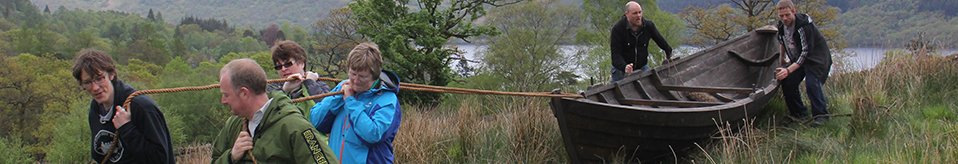
Tarbet Isle excavation. Thanks also to Peter McFarlin and Preston McFarland, Northlight Heritage were commissioned to carry out a 2-week excavation on Tarbet Isle in October 2014. Huge thanks to Peter and Preston for allowing us to share the exciting results! Click here to read more...
Clan MacFarlane Worldwide are currently raising funds to translate and transcribe 110 documents originally collected by Walter MacFarlane, the Scottish antiquarian and 20th chief of Clan MacFarlane, and later by Dr. W. H. Hill. These 'muniments', including two dating back to the 13th century, include 33 written in Latin, some in Scots, and the remainder in earlier English. The documents include legal and business records relating to Clan MacFarlane chieftains, their families, and clan members, as well as agreements and communications between the Clan chiefs, the Crown, other clans, and Scottish nobles. Some of the original documents have become damaged during centuries of storage and handling in less-than-ideal conditions, making their translation difficult and time consuming. Most of the already completed documents have been transcribed and translated by Scottish experts, and completion of this project will give CMW and other researchers access to important information about Macfarlane clan history. It is hoped that the translated/transcribed documents will eventually be publicly available. Please contact CMW via their website for more information, or if you might be interested in donating to the project.
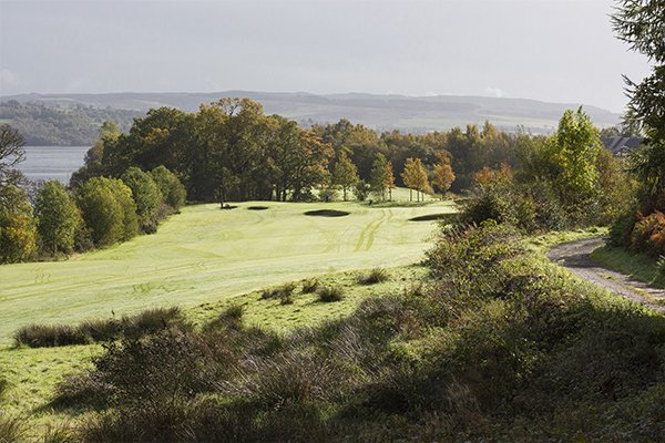
Next time you pass the manicured greens and fairways of The Carrick Golf Course at Mid Ross, spare a thought for how dramatically this landscape and its use have changed over the last 10,000 years. Extensive archaeological excavations carried out here by Glasgow University Archaeological Research Division (GUARD) between 2003 and 2005, during the construction of the golf course, revealed exciting evidence of past inhabitants and ways of life, with important implications for life on the shores of Loch Lomond and beyond.
The hugely complex nature of the excavations and post-excavation analyses, coupled with management/staff changes at both GUARD and The Carrick, have meant that the full results of these excavations have been very slow to surface…. However, we’re delighted to say that we now have access to the findings, and hope to highlight some bits over the next few weeks. The archaeological information is based on the forthcoming publication, ‘Living and Dying on the Bonnie Banks: Ten Thousand Years at The Carrick, Mid Ross, Loch Lomond’, by Alistair Beckett, Gavin MacGregor, Donna Maguire, David Sneddon, Beverley Ballin Smith & Bob Will. Thanks to Dr. Iain Banks (Glasgow University) and Hugh McBrien (WoSAS) for providing us with the information and giving us permission to use it. We’ve only picked out a few highlights that particularly interested us, and continue to look forward to publication of the full report. Apologies that our summary of this has currently ground to a halt - too many calls on our time at the moment, but we'll try and resume shortly!
Importantly, please note that none of the excavations are now visible – all have been thoroughly recorded and/or preserved and are now hidden beneath the golf course. Please observe the Scottish Outdoor Access Code, and stick to the paths when crossing the golf course.
Click here for more info!
Excavation at the head of Loch Long. Argyll Archaeology carried out an archaeological excavation at Succoth, at the head of Loch Long, prior to the recent housing development. Click here to find out about some of the area's very early inhabitants!
Scottish Community Heritage Alliance - A new project focusing exclusively on community heritage in Scotland has been launched - we hope you will get involved and have your say! Read more here...
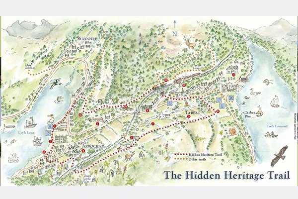
Following the huge demand for our leaflets describing the Hidden Heritage Trail between Tarbet and Arrochar (which resulted in us running out of leaflets very fast!), Arrochar and Tarbet Community Development Trust has produced some lovely new leaflets - Arrochar and Tarbet Paths - with info on the Hidden Heritage Trail and other walks in the area. Thanks to Friends of Loch Lomond and The Trossachs for funding the first print run of these, and to Loch Lomond and The Trossachs National Park for graphic design of the leaflet. Leaflets available for a small donation from the 3 Villages Hall or Community Cafe in Arrochar, and from various hotels and B&Bs in the area. You can also download a copy here, but it isn't as clear as the printed version - use this as a taster then pick up a printed copy and donate when you're in the area! (All donations go to printing further copies of the leaflet or to other community projects). Click here for more info.
Phone app. Thanks to St. Andrews University Open Virtual Worlds group, we have a phone app for our heritage trail! Special thanks to Ade Fabola and Alan Miller for making that possible. You can download a version of the 'Arrochar Mobile App' for Android devices here, or an IOS version from iTunes here. We'd love to hear from you if you've tried it. Let us know if there are any glitches, and please send us any photos or video clips you take along the way :) Sorry - seem to be some problems with this at the moment - we'll see if we can get these fixed.
Please note that our email address is now: hiddenheritagevikings@gmail.com
We do our best to keep this site up to date, with limited time and resources! Please let us know if any of the links don't work and we'll try and fix them.
Although the Hidden Heritage Project has drawn to a close...... :(
... you can check out the Results page and our Facebook page to see the various reports and outcomes.
- RESULTS! Read/download a copy of the archaeology report prepared by Northlight Heritage
- The 'Isthmus Tapestry' has been on display in Helensburgh Library, as part of Dunollie Castle's 'Fasanta' textile exhibition, and at Scotland's Community Heritage Conference. Contact us if you'd like to display the tapestry at your event.
- Check out the plan of Ballyhennan graveyard with photos of each stone and information on the inscriptions
- Try out the Hidden Heritage Trail! Download a map and leaflet
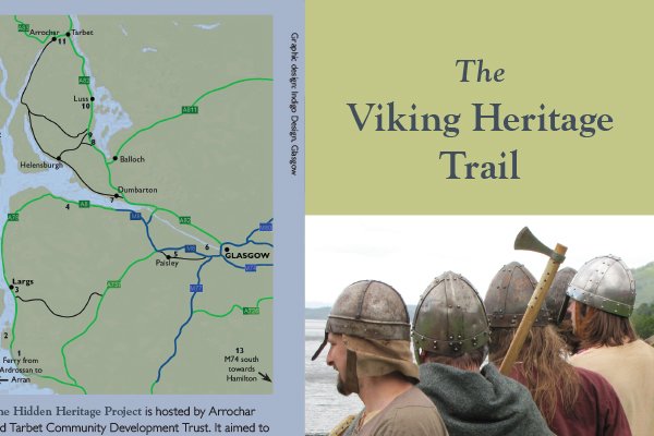
- Find out about Viking sites around the Clyde and download a map and leaflet
- View/download a copy of 'The Gaelic Place Names of Arrochar Parish', researched and compiled by volunteers, Elizabeth Carmichael, Irene Wotherspoon, Libby King and Ann Bray. (It's a large file so may take a while to download). We also have some (free) hard copies of this lovely booklet available - contact us if you'd like one.
- We have free copies of our photography book, 'Reflections of a Hidden Landscape', produced to record and celebrate the project. Contact us if you'd like one.
- We have put together some 'Viking resource boxes' including costumes, replica artefacts and written material, suitable for primary age children. Click here to find out more about these.
Blog
Click on the link here to check out our Facebook page.
Events
Click here to find out about forthcoming events and how to get involved.
Timeline
Click here to see our timeline of events.
Location
Click here to find out where the Hidden Heritage Project is taking place.
Contact Us
Click here for our contact details.