Tarbet Isle
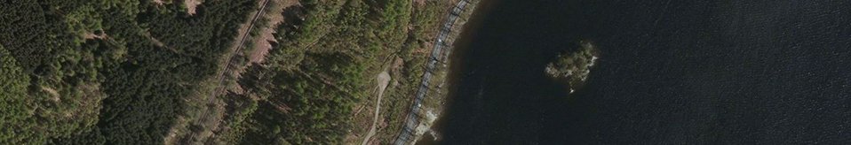
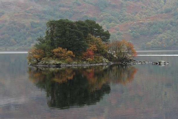
Tarbet Isle lies in Loch Lomond, within a few hundred metres of the shore at Tarbet. It is also known locally as 'Honeymoon Island', because of the tale that newlyweds were sent to spend a week on the island - if they were still on good terms at the end of the week, it was deemed a sign that the marriage would be successful!
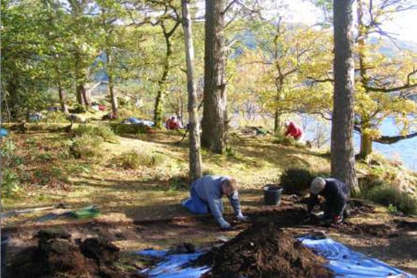
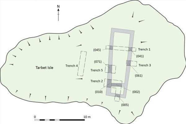
Arrochar and Tarbet are steeped in Macfarlane heritage, which led Peter McFarlin and Preston MacFarland (members of Clan MacFarlane Worldwide) to commission Northlight Heritage to undertake a 2-week excavation of Tarbet Isle. Peter and Preston commissioned the dig privately, with the aim of shedding some more light on the lives of their ancestors. The remains of what appeared to be a two-roomed stone building were visible on the island, initially identified by Fiona Baker (Firat Archaeological Services) during a survey of the islands in Loch Lomond. With permission from the landowner, Luss Estates, and under the supervision of WOSAS (West of Scotland Archaeology Services), five small trenches were excavated in October 2014. A few lucky volunteers had a chance to help Peter, Preston and Heather (Dr. Heather James, Northlight Heritage), but given the small size of the island, the National Park imposed a limit on the number of people allowed on the island at any one time, as well as restricting the timing of the dig to avoid disturbing nesting birds.
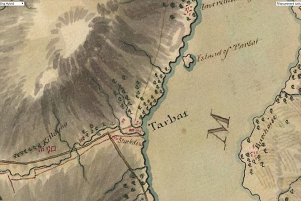
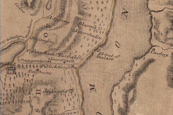
Although nothing was known about the age or function of the building, one of Timothy Pont’s maps from the late 1500s depicts ‘Yle Terbert’, apparently occupied by a substantial two-story building with a high, gabled roof and a small annex to one side. Intriguingly, however, the notes that accompany Pont’s maps, make no mention of any building on the island…. No other historical maps seem to show any signs of a building either, but the remains still visible today indicate that there has certainly been one at some time! Peter and Preston’s excavation offered a perfect opportunity to try and solve the riddle.
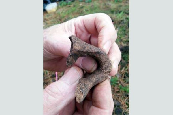
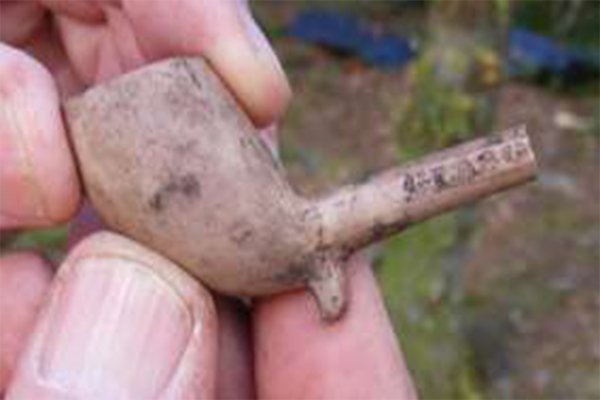
The excavations revealed the remains of a two-roomed, trapezoidal-shaped, drystone structure. The lack of much rubble indicates that it was probably never a large stone building, but more likely a wood or turf structure built on low stone footings. The north room contained a burnt layer of coal and wood ash, probably from a hearth, implying that people had once lived in it. Several pottery sherds and a coin dating to the 17th century were found, suggesting that the structure had been occupied in the 17th & 18th centuries. Maybe the island had been used for storing things out of easy reach? Or maybe it was used a lookout by the Clan Macfarlane, allowing them to control movement up and down the loch? It seems very unlikely that this was the grand building drawn by Pont, and close examination of his maps and notes suggest that confusion may have crept in somewhere between his making the notes and drawing the maps – possibly not helped by the presence of ‘Inveruglas’ to the north, and ‘Nether Inveruglas’ (now Inverbeg) to the south…. The fact that the maps are not infallible is borne out by the apparent absence of Inveruglas Isle and its substantial castle!
The exciting discovery of a single pottery sherd from a large, flat-rimmed bucket urn was also found within some rubble debris. This has been identified as part of a Bronze Age burial urn, which may have been used to hold cremated human remains about 1500 to 1000 BC. A cairn of stones over the urn may have been reused to construct the 17th century building.
View or download the complete excavation report here.
Huge thanks to Peter and Preston for allowing us to share these exciting results!
Blog
Click on the link here to check out our Facebook page.
Events
Click here to find out about forthcoming events and how to get involved.
Timeline
Click here to see our timeline of events.
Location
Click here to find out where the Hidden Heritage Project is taking place.
Contact Us
Click here for our contact details.